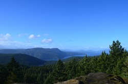
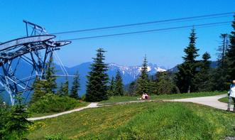
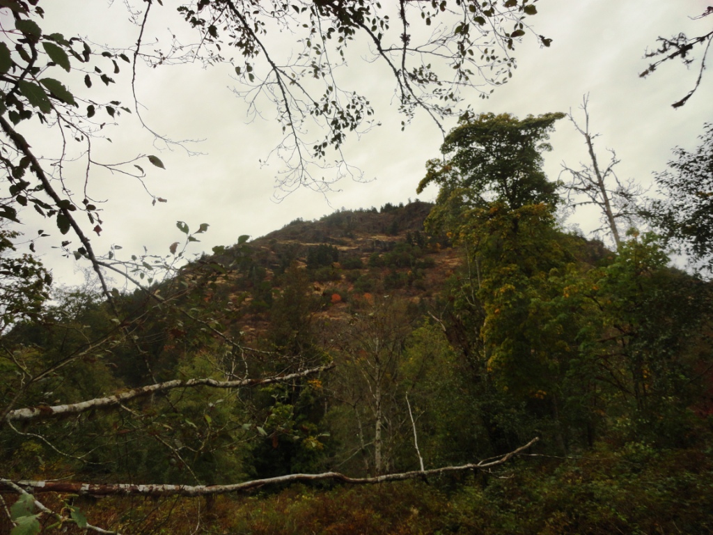
 Mount Work - what a strange, not particularly enticing name. Who wants to hike a mountain when they are reminded it is work? Maybe Mt. Stroll in Woods would be a better name. But it should actually be called Mount Wark - as it was named after John Wark (the fur trader, not the soccer player). When Wark joined the Hudson's Bay Company in 1814 he Anglecized his name to Work... and there you go - the story behind the name Mt. Work. The main excitement of the day was the wind... and what a wind it was. Something maybe only Island people would understand, because I have never felt wind like this in Vancouver. The entire hike up I could hear the trees cracking and popping as the wind readjusted and tested them. Small branches breezed my my head. I came up with my plans for if a) a tree was going to fall on me - run like hell and b) a giant branch came sailing at me - jump, duck, run.... It was windy. I found it rather humurous that the beginning of the trail had a handful of signs pointing to the summit, but once I got up there... I had no idea, and still don't really KNOW, where the summit was. There was a flat expanse of rock with a beautiful view up Island that I will call the summit - unfortunately I did not take much time to enjoy the vista because the wind was particularly strong without the trees to break its full force. I had to brace myself, legs apart, knees bent, shoulder to the wind... just to keep standing. I squatted down (less surface area?) to take a picture, and was blown over. So needless to say, I did not stop to enjoy my snack. The trail carried on past the summit and down the other side - I followed this part way, still in search of the perhaps official Summit, but turned back after awhile - the trail was becoming slightly hard to follow and my ears were particularly icy.
If you are thinking about hiking Mount Work - check out this project I am working on for some more details.
 Found myself the most wonderful park - miles and miles of trails just waiting to be explored!! I have been to Gowlland Tod Park twice now, and still feels like completely unchartered territory.
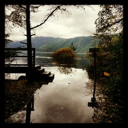
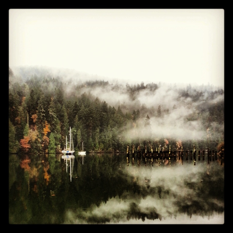
My first adventure is one I plan to take all future visitors to - it is just a short walk, maybe a couple of kilometers through the woods, to the Tod Inlet. There is the most picturesque yacht moored in the inlet amongst the fog. I mean seriously just look at it - its like out of a postcard or something.
Throughout the trail, I kept seeing signs of old houses having been here - old cement foundations with trees growing out of them, that type of thing. So I looked it up when I got home, and all it really tells me about it is that there has been a long history of people living in this area - as well, it used to be part of the property where the Vancouver Portland Cement Company was (happen to remember this from the Butchart Garden?? Also was part of the Cememnt Company).
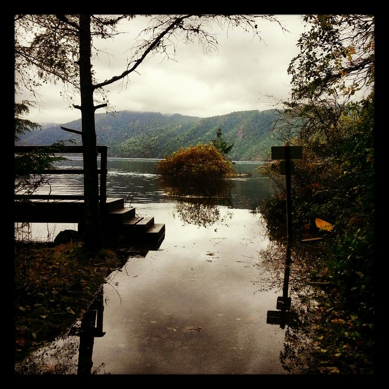
The next time I went to the park, I explored from a different trailhead - McKenzie Bight. The first trail I picked led me downhill for about a km and a half - straight into the ocean!
 The river was so high, the trail was underwater, and not just a little bit where you can just wade through, but like three feet underwater. I didn't feel like going for a swim, so I turned around and headed back up the hill.... I was running today, so it wasn't a particularly happy moment. The next trail I took - The Timberman Trail, was much better - just nice rolling hills leading up to a view over the Saanich Inlet. At this point I was out of time and had to turn back, but I think there was at least 20km of trail past that point - until next time!
For more information and to have a look at the trail maps check out:
http://www.env.gov.bc.ca/bcparks/explore/parkpgs/gowlland_tod/
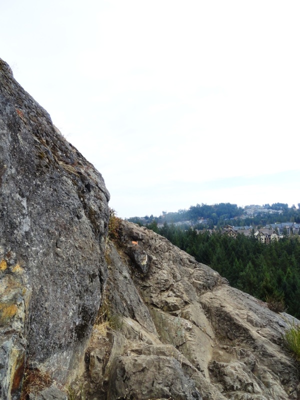
 Listed #12 on the Top Things to do in Victoria, right after Shop til you Drop (priorities people), is Goldstream Park, and Mt. Finlayson. From what I have been hearing from people Mt. Finlayson is an extremely popular hike in this area - similar to the Grouse Grind in Vancouver, or the Chief in Squamish. I find it some blend of the two, but also very different. If is steep, like seriously steep. If you aren't short of breath by the top, you are... superman? It has a lot more scrambling over rock and between crevasses than the Grind, but no chains and ladders like the Chief. The biggest difference for me, was that when I got to the top, I was ready for more.
At 419m the hike probably takes about half an hour - I didn't time it, just guessing. And although I was a sweaty mess - I wanted to be higher, go farther - my legs were itching. And although the views were spectacular, I am spoilt by the views at home, and kept on trying to figure out where the water was? I mean there was the ocean in the distance, but .... I guess I am just going to have to accept this type of beauty for what it is, and not compare it to Squamish...
It really was a great hike, and another difference I felt was the friendliness of the hikers. Although I always hike in my Vibrams, and occasionally I will get the odd comment about them - here everyone seemed to want to talk to me - I had at least 10 people ask me about them - and those I passed who didn't, still said hello and occasionally some other quip.
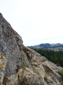 Can you spot the trail in front of me? Now for my history component... :) Mt. Finlayson was named after Roderick Finlayson (originally Scottish) who lived between 1818 and 1892. He was a fur trader turned politician as he joined the legislative council in 1851 (he was also Chief Accountant of Fort Victoria!). When he retired from politics in 1872, he became quite the business man managing his farm and estates. In 1878, he was elected Mayor and held that post for a year - during that year the City Hall was constructed. Despite all this I am not quite sure what this man did that was so great a mountain got named after him - maybe it was City Hall? But I am not enitrely sure City Hall was his idea, it was just built during his term in office... hmmmm... will need more info on this guy.
The trial (The Prospector's Trail) was built in 1971 by the Outdoor Club of Victoria using old prospector's routes and passing two old mineral claims - I either walked right by these without noticing, or they were not on this part of the trail. Hiking down the mountain, I somehow got myself off the main trail, and started freaking myself out about bears and cougars - so I made up a lovely song to sing..... it was something like "Oh trail, where are you?" repeated a million times..... but it was a success, no creatures trying to eat me.
After the hike, I still had a lot of energy so I ran around the park at the bottom a bit - followed trails along the stream - the salmon spawning yet - is it October? Supposed to be pretty cool, I'll be back. There is also a cool Nature Center with stuffed animals of all sorts (I like the beaver) - and I saw some kids wearing Jerry the Moose Antlers - these threw me back to my childhood where the Park Rangers across the road used to give Geordie and I these hats if we went to a nautre talk or something like that. I found it crazy that after all this time Jerry the Moose is still the exact same.
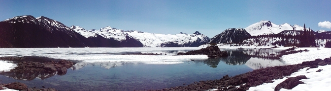
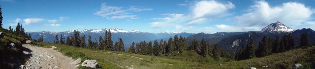
 Not even 20 minutes from Squamish is the trailhead to Elfin Lakes. This 11km trail gains 2,000 feet of elevation through Garibaldi Provincial Park - half of it through the forest and half through Alpine meadows... think Heidi and the Sound of Music. I swear I could have been in the Alps. The trail is an old road created to access Diamond Head Chalet which was built by two young Norwegian men (Ottar and Emil Brandvold) and a Canadian woman (Joan Matthews) in the 1940s. Diamond Head chalet was the first high-altitude ski lodge in BC north of Vancouver - at this time people had to take a 4-hour ferry ride just to get to Squamish - this was followed by a train to Garibaldi station, and an overnight there before even beginning the hike in!! Pretty cool. I just started reading about these 3 people and find them fascinating - they were all competitive skiiers who met in a tournament in Banff... the three of them dreamed of creating a hut to hut system for hikers and skiiers throughout Garibaldi park... and went on to do so. Now if these people weren't cool enough already - Joan was also the first graduate in sculpture from the Vancouver School of Art. They developed a rehabilitation program to have war veterans come up into the mountains to help build cabins with the main focus being on the men's mental and physical health. They also adopted a local deer as their pet - "The only thing about that deer," laughs Ottar, "was that we could never train him not to get into our bed." After Joan and Ottar had two kids, Joan stayed down in Squamish more... but wasn't just a housewife - she became the chief ambulance driver for the area.... wow this woman is my hero. To read the whole history of this area - check out this article.
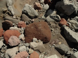 Lava rock! So back to the present.... Sonia and I hiked in early saturday - carrying all our gear for camping as we had heard this place was seriously popular and we expected the hut to be full up from people who hiked in on friday. Not the case at all. There were maybe 6 people staying there, but the campground was almost full. After the hike in, we dropped off our stuff, and carried on for another 10km hike or so. We wanted to go check out Opal Cone - which is some sort... of cone? But we had to turn around after we hit a large, roaring creek with no easy way of crossing, and we couldn't see the trail on the other side. I am still unsure if we actually saw Opal Cone or not... it is a Cascade Volcano responsible for 15km of dacite lava flow (sounds like this is a wrinkly rock ridge). I think we must have seen this... oh well.
We hiked back to the hut - jumped into the glacier cold lake, and cooked ourselves the most delicious steak and potato dinner. Sonia even had a glass of red wine. We sat on the porch and played crib watching the sun go down....
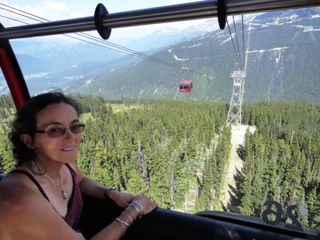
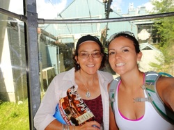 On a bit of a spur of the moment, my mom and I decided we should take a trip to Whistler, so we did. In a nutshell we rode the Peak 2 Peak, hiked the Alpine trails at the top of Blackcomb for a couple of hours, watched a terrible movie on tv (Just Friends, just terrible), went for a late night leap into the lake, cycled around the Valley trail... that's about it.
The Peak 2 Peak is probably the biggest tourist attraction in Whistler (apart from the mountain biking and skiing). It was built in 2008 to link Whistler Mountain to Blackcomb Mountain (hence Peak 2 Peak). It holds the world records for the longest free span between ropeway towers (3.03km) and the highest point above ground (436m...1,430 feet). It cost $51 million to build... ah so that's why it is a steep $50 to go on the thing...
 Peak 2 Peak Reading about the construction of this thing is pretty incredible! The concrete for the foundations had to be transported up the mountain by helicopter, the cables had to be shipped from Europe - and because they were so heavy had to go to Washington where the largest crane is - where they had to be picked up by a special heavy load tractor and trailer from Quebec, they had to bring one of the few haul-rope splicers in North America in from Wyoming.... suppose this isn't so interesting to people who know what kind of work goes into making these things, but I had no idea!! Cool.
Construction only took one year longer than it was supposed to (which seems pretty good?) and the opening ceremonies featured someone base-jumping from the middle of the gondola!!!
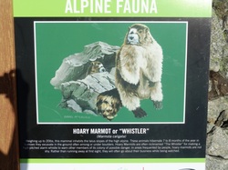 So everyone in Whistler really is from Australia - everyone! Click here.... Whistler was originally named London mountain (due to all the fog), but acquired the name Whistler from the call of the Hoary Marmot.... despite the large population in the area, we didn't see any. We did however hear many...
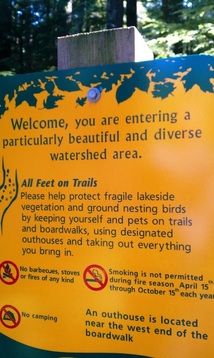 Warning: You are entering a particularly beautiful area! :D
I am constantly being blown away by the beautiful places in my own backyard. Just an hour or so into the woods in West Vancouver is Whyte Lake - inviting green water nestled in between giant Cedar and Douglas fir trees. The water was deliciously warm after being heated by the sun all morning, calling for us to go for a swim (and also very important - it seemed leech free). It was quite a popular spot and we hadn't anything to swim in, so I will go back another day for a dip. And probably many more days after that.
During our hike I learnt a few interesting tidbits of information from my companions. Did you know that the Guinness family (of Ireland) built the Lion's Gate bridge? Our city would cease to function without this bridge - it is a very big deal. They also own the plot of land our trail started in and are building a development in the area.
Another thing topic of conversation - A man in Florida went to retrieve his golf ball from a water hazard on the green and a croc grabbed his leg (it was going for the ball, but overshot a tad). His quick-thinking friend hit the croc with a golf club, only to be accosted for hitting the thing by an irate woman who had befriended the hungry crocodile. She had built their friendship on marshmallows.... which look suspiciously like golf balls.... So I also learnt on that hike that you probably shouldn't feed golf-course-resident crocodiles marshmallows.
Oddly enough with an entirely different group of people later that night marshmallow eating crocodiles came up in another conversation.... how bizarre.
 Remember this large lump of granite? This is the Chief - besides the Grind, this is probably the most popular hiking destination in the Vancouver area.
It is claimed to be the second largest monolith (single massive rock) in the world... what is the first? Well the only other one I can think of is Ayer's rock, so that's my guess. Turns out monoliths are quite an interesting topic themselves - did you know in Lalibela, Ethiopia there are 11 churches carved in the 12th century from red monolithic volcanic rocks; and they are considered the 8th wonder of the world? Ok that's enough following wikipedia into the depths of random facts. I could get lost in there for days.
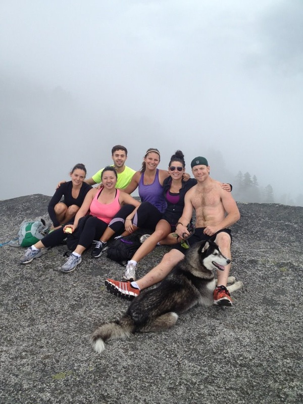
 Back to the Chief - there are three peaks to hike to and it takes about 5 hours to do them all (although that is just a bit of hearsay, I have never done it). We just went to the first peak, and because the trail becomes more difficult for dogs, we turned around there. As it was, Tim (the dog) had to be carried up a few ladders, but ultimately seemed to be enjoying himself.
Normally the summit provides a fantastic view of Howe Sound and Squamish below, but we found ourselves in the middle of clouds, that only blew off for glimpses of the town below. It was pretty cool though to be surrounded in clouds, completely in another world.
An update on something I mentioned ages ago - the 40km hike from Horseshoe Bay to Deep Cove that I wanted to do... well my friend Michelle is going to do it with me next Monday!! Yes :D I am so excited!
 The Grind as the locals call it, or the Grouse Grind, or Nature's Stairmaster, is a 2.9km hike up the face of Grouse Mountain.
The website warns that this is a seriously difficult trail and that there are perhaps better options for the "average hiker." People take on average an hour and a half to climb the 2,830 stairs and gain 2,800ft of elevation. You can always tell the locals from the tourists - and there are about half and half this time of year. (Record is 23 minutes!) The locals carry nothing - maybe a water bottle, and are wearing workout clothes and runners - in other words, they know what they are in for. The tourists have no idea that this is not a scenic hike, but an intense, nausea-inducing sort of satisfying torture. They are often spotted having a break on the side of the trail, often in jeans, and sometimes even mini-skirts and high heels. I must say props to them. I find it noticeably harder to go from Vibrams to proper runners... I don't think I could even do it in heels. Mind you I can't do much in heels....
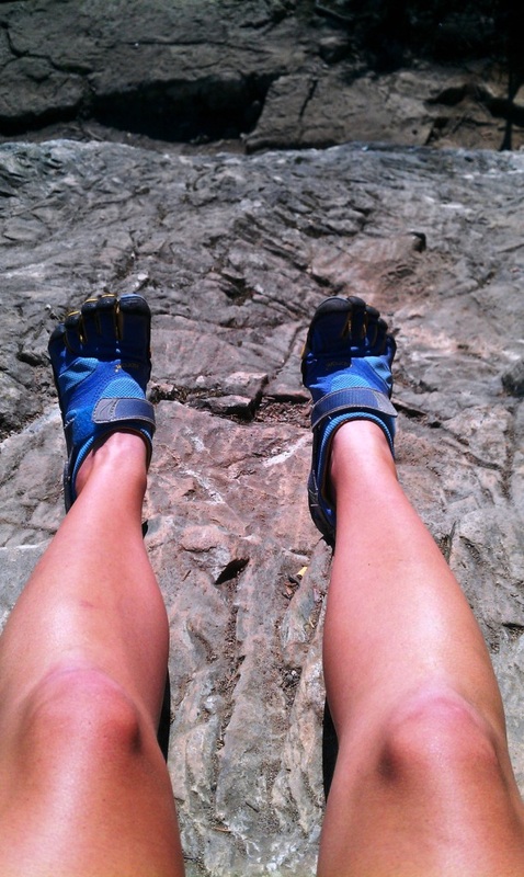
 These are Vibrams by the way (on the right) - basically gloves for your feet, and the most fantastic things in the world... well apart from straight old bare feet, but these provide a little protection from the elements.
So back to the Grind. Hikers first came to the mountain in 1894 - a hunting party found (and shot) a blue grouse here and named the mountain after the bird. It wasn't until 1981 that the local mountaineering club started following the steep animal paths and established some semblance of the trail we know today.
The grind is something I do purely for the intense workout, that and my competitive nature always pushing me to get a better time. I used to do it in 45 minutes back in the days when I ran a lot more, so I would like to get back to that point. By the end of the summer.... and by the end of next summer, maybe beat the standing women's record of 31:04? hmmm.... aim high right?
There are quite a few social rules to doing the grind. For example, I had to tell my mom that I do not talk when I do the grind. Seriously, it is not a socializing time - if you want to socialize, go do one of the much, much more enjoyable hikes on the North Shore. And if you are in a group there is the tricky situation of differing physical abilities. It is very frustrating for me to have someone who is in much better shape than me wait every few minutes for me to catch up and then go dart ahead before I even have a chance to catch my breath.... This type of situation happened once on a date once - I have never sworn so much (luckily he was a good sport and took it well). Either make it look like you are at my pace too and walk with me, or just leave me behind entirely and meet me at the top. Ok enough ranting.
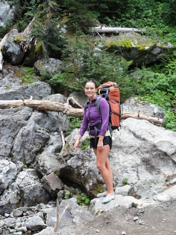
 I had no idea that just an hour and a half north of Vancouver I would find complete paradise!
Garibaldi Lake.
After trekking 9km through beautiful, lush Westcoast forest, we emerged in the middle of a scene straight out of a BC tourism ad. I have never seen anything like this before! And to think it existed this whole time only miles away. What have I been doing with my life?
Garibaldi lake is 1,500m above sea level and is surrounded by mountains. These peaks are volcanic along the north, south and west side. At some point in history two volcanoes nearby erupted forming The Barrier - this lava dam is over 300m (1,000ft) thick and 2km wide. The Barrier is holding back the water from the Garibaldi Lake system - which if it ever let loose, would do some serious damage to the nearby town of Squamish. This is actually the reason why my brother and sister-in-law cannot get flood insurance on their home. The most recent movement in The Barrier was in 1855-6 when the debris flow created a large boulder field giving the name to Rubble Creek. In 1981 the BC government decided the instability of The Barrier made living in the nearby village of Garibaldi (which no longer exists) was too dangerous, so all the residents were relocated to a few Estates that were being built to the north. At this time plans were also given up that would have made Garibaldi into the main ski resort in the area - instead the company Garibaldi Lifts went on to open Whistler Blackcomb.... interesting!!
|


 RSS Feed