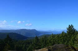
 Mount Work - what a strange, not particularly enticing name. Who wants to hike a mountain when they are reminded it is work? Maybe Mt. Stroll in Woods would be a better name. But it should actually be called Mount Wark - as it was named after John Wark (the fur trader, not the soccer player). When Wark joined the Hudson's Bay Company in 1814 he Anglecized his name to Work... and there you go - the story behind the name Mt. Work. The main excitement of the day was the wind... and what a wind it was. Something maybe only Island people would understand, because I have never felt wind like this in Vancouver. The entire hike up I could hear the trees cracking and popping as the wind readjusted and tested them. Small branches breezed my my head. I came up with my plans for if a) a tree was going to fall on me - run like hell and b) a giant branch came sailing at me - jump, duck, run.... It was windy. I found it rather humurous that the beginning of the trail had a handful of signs pointing to the summit, but once I got up there... I had no idea, and still don't really KNOW, where the summit was. There was a flat expanse of rock with a beautiful view up Island that I will call the summit - unfortunately I did not take much time to enjoy the vista because the wind was particularly strong without the trees to break its full force. I had to brace myself, legs apart, knees bent, shoulder to the wind... just to keep standing. I squatted down (less surface area?) to take a picture, and was blown over. So needless to say, I did not stop to enjoy my snack. The trail carried on past the summit and down the other side - I followed this part way, still in search of the perhaps official Summit, but turned back after awhile - the trail was becoming slightly hard to follow and my ears were particularly icy.
If you are thinking about hiking Mount Work - check out this project I am working on for some more details.
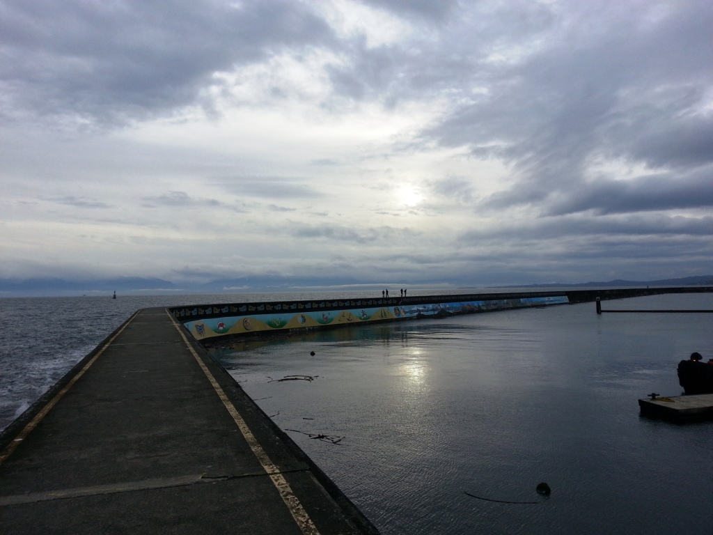
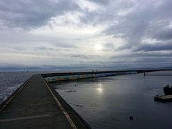 A beautiful stretch of Vancouver Island waterfront follows Dallas Road from Clover Point Park to The Breakwater at Ogden Point. This a fantastic place to run, or walk, not only for the spectacular views of the Olympic mountain range in the distance, but also for the little pieces of history peppered along the way.
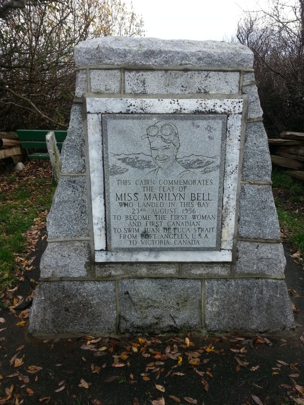
First you meet Miss Marilyn Bell - the first woman and first Canadian to swim across the Strait of Juan de Fuca. Two years before this feat, she swam across Lake Ontario. Three swimmers began at the same time - all wanting to be the first person to cross.
 Bell had been offered $10,000 to undertake the task to increase publicity for the Canadian National Exhibition. She declined because she thought this offer snubbed other swimmers. So what happened in this race to cross the lake - well the American, Florence Chadwick, had to forfeit due to stomach pains and vomitting, and the other woman - well not much info about her, just that she failed..... so Bell became the first person to swim this distance as well. Apparently there were crazy winds, incredibly high waves, and lampreys trying to take bites out of her...... sounds fun!! I'm serious.
The following year she became the youngest person to swim the English Channel, and the next year was her epic swim from Port Angeles to Victoria - 18.3 miles in 11 hours 35 minutes.
Along Dallas road, there is another commemorative plaque for a great Canadian - Terry Fox.
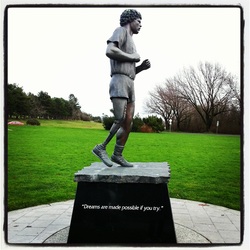 I am sure you all know the story of Terry Fox - my all-time biggest hero.... I won't go into the details of it now - perhaps a whole blog entry devoted to his inspiring life in the future.
Terry's statue if located at Mile "0" - the unofficial beginning to the Trans Canada Trail Also the end point of two other amazing runner's Al Howie and Stephen Fonyo, who both ran across Canada.
Everytime I see the Mile "0" sign, I dream about riding my bike down here from my house, and beginning my ride to Newfoundland... then down to visit Emily in Hanover, and across the states..... dreaming. No matter what I do, I will for always and ever be dreaming!
Two other interesting sites along the way are glaciar-marked rocks from about 10,000 years ago... I didn't actually find these markings...... and a memorial or sorts to a ship that sank, but no casualties. Although all this history is inspiring, interesting, educational, etc... the highlight of the run was seeing two pelicans!!!
Seemed so out of place here..... I don't know for sure, but shouldn't they be somewhere warmer than the frigid Pacific Northwest waters???!
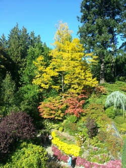
 Found myself the most wonderful park - miles and miles of trails just waiting to be explored!! I have been to Gowlland Tod Park twice now, and still feels like completely unchartered territory.
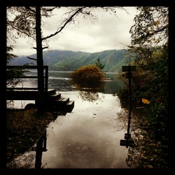
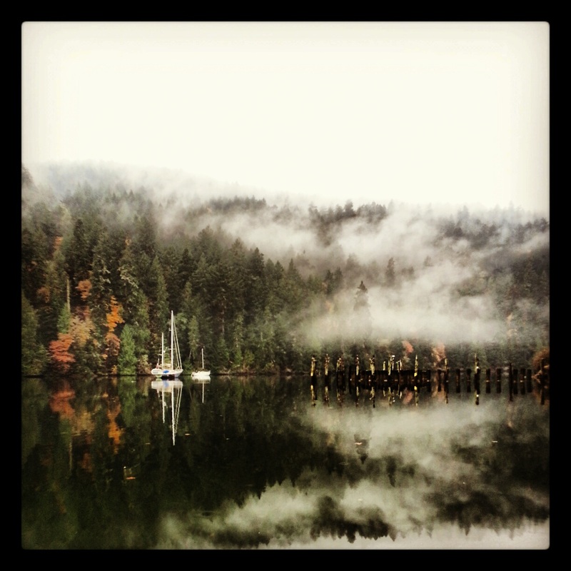
My first adventure is one I plan to take all future visitors to - it is just a short walk, maybe a couple of kilometers through the woods, to the Tod Inlet. There is the most picturesque yacht moored in the inlet amongst the fog. I mean seriously just look at it - its like out of a postcard or something.
Throughout the trail, I kept seeing signs of old houses having been here - old cement foundations with trees growing out of them, that type of thing. So I looked it up when I got home, and all it really tells me about it is that there has been a long history of people living in this area - as well, it used to be part of the property where the Vancouver Portland Cement Company was (happen to remember this from the Butchart Garden?? Also was part of the Cememnt Company).
The next time I went to the park, I explored from a different trailhead - McKenzie Bight. The first trail I picked led me downhill for about a km and a half - straight into the ocean!
 The river was so high, the trail was underwater, and not just a little bit where you can just wade through, but like three feet underwater. I didn't feel like going for a swim, so I turned around and headed back up the hill.... I was running today, so it wasn't a particularly happy moment. The next trail I took - The Timberman Trail, was much better - just nice rolling hills leading up to a view over the Saanich Inlet. At this point I was out of time and had to turn back, but I think there was at least 20km of trail past that point - until next time!
For more information and to have a look at the trail maps check out:
http://www.env.gov.bc.ca/bcparks/explore/parkpgs/gowlland_tod/
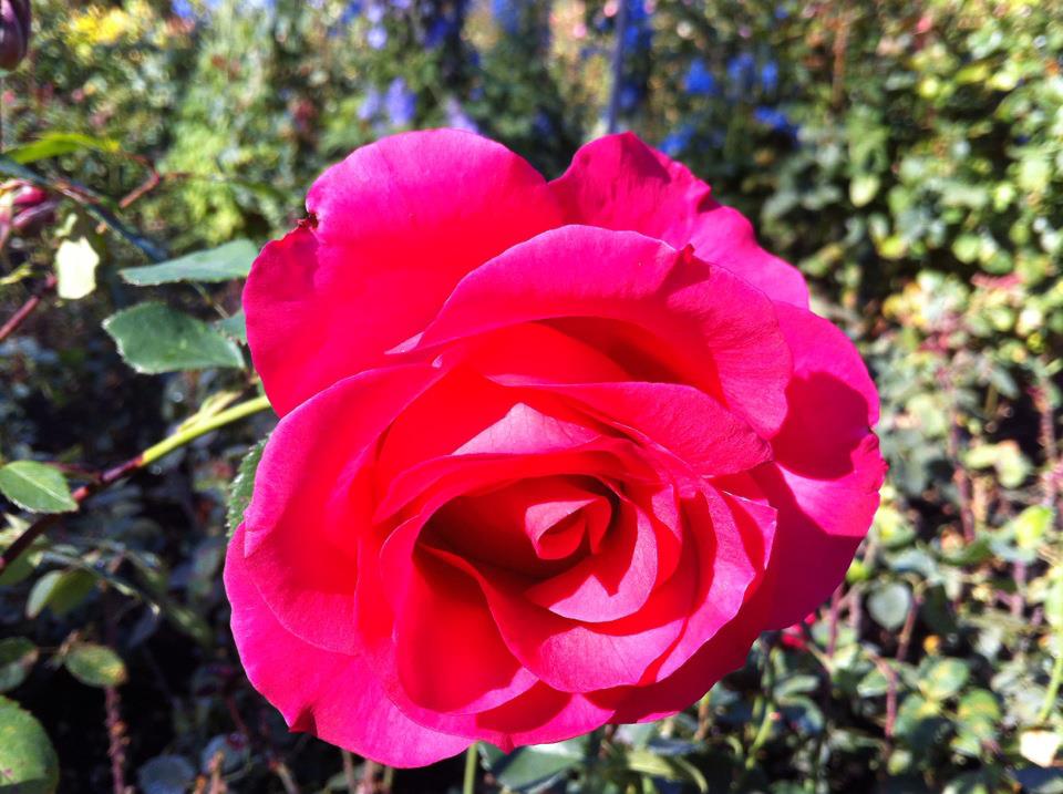
 Something you should know about me before I start talking about the Butchart Gardens, is that although I love nature, I am not really a fan of gardens. Perhaps if they were growing carrots I would be... there is nothing tastier than a carrot fresh pulled from the ground. But... walking through rows and rows of roses and tulips, and whatever other flowers exist, oohing and aahing over their beauty... is not my cup of tea. So when my sister-in-law suggested a trip to the Butchart Gardens and proceeded to get to the level of excitement normally only reserved for Christmas morning, I was hesitant at best.
But everything is what you make of it right? It was a beautiful day, and I was with a group of amazing... and rather silly... women. We took pictures among the roses, in the Japanese gardens with cool trees, on the rocks through a pond as frogs, in the majestic lawns pretending to be fancy statues.... I was surprised when I realized I was having fun.
 What is really cool about the Butchart Gardens is the fact that the whole area used to be a limestone quarry. Robert Pim Butchart and his wife Jennie moved to the Victoria area in the early 1900s specifically for the limestone deposits - limestone was (or is? I don't know much about this) used to make cement. When all the limestone had been removed, Jennie had the idea of making the ugly pit into a "Sunken Garden." The rest of the gardens came later reflecting the couple's world travels - A Japenese garden, an Italian garden and a rose garden. Now the question is, what country is the Rose garden reflecting? England? My knowledge of flowers and the like is startlingly low. Anyways, Mr. Butchart also had an interest in collecting birds and had an interesting array of ducks, peacocks, pigeons and parrots. People started hearing about these gardens and by the 1920s over 50,000 people would come visit each year. This number today approaches 1 million. And now I feel complete, I am one of those million for the year. Living in Victoria and not having been to the Butchart Gardens is like living in Vancouver and not having been to Stanley Park - just not acceptable. History thanks to the Butchart Gardens website.
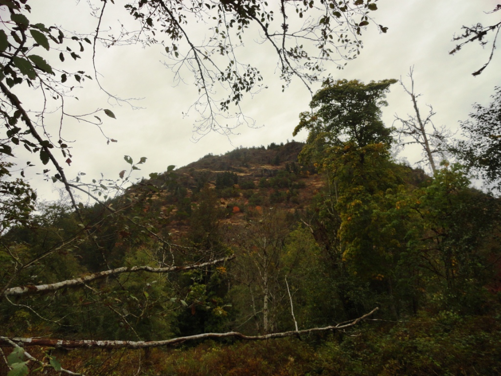
 Listed #12 on the Top Things to do in Victoria, right after Shop til you Drop (priorities people), is Goldstream Park, and Mt. Finlayson. From what I have been hearing from people Mt. Finlayson is an extremely popular hike in this area - similar to the Grouse Grind in Vancouver, or the Chief in Squamish. I find it some blend of the two, but also very different. If is steep, like seriously steep. If you aren't short of breath by the top, you are... superman? It has a lot more scrambling over rock and between crevasses than the Grind, but no chains and ladders like the Chief. The biggest difference for me, was that when I got to the top, I was ready for more.
At 419m the hike probably takes about half an hour - I didn't time it, just guessing. And although I was a sweaty mess - I wanted to be higher, go farther - my legs were itching. And although the views were spectacular, I am spoilt by the views at home, and kept on trying to figure out where the water was? I mean there was the ocean in the distance, but .... I guess I am just going to have to accept this type of beauty for what it is, and not compare it to Squamish...
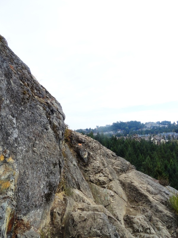
It really was a great hike, and another difference I felt was the friendliness of the hikers. Although I always hike in my Vibrams, and occasionally I will get the odd comment about them - here everyone seemed to want to talk to me - I had at least 10 people ask me about them - and those I passed who didn't, still said hello and occasionally some other quip.
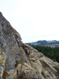 Can you spot the trail in front of me? Now for my history component... :) Mt. Finlayson was named after Roderick Finlayson (originally Scottish) who lived between 1818 and 1892. He was a fur trader turned politician as he joined the legislative council in 1851 (he was also Chief Accountant of Fort Victoria!). When he retired from politics in 1872, he became quite the business man managing his farm and estates. In 1878, he was elected Mayor and held that post for a year - during that year the City Hall was constructed. Despite all this I am not quite sure what this man did that was so great a mountain got named after him - maybe it was City Hall? But I am not enitrely sure City Hall was his idea, it was just built during his term in office... hmmmm... will need more info on this guy.
The trial (The Prospector's Trail) was built in 1971 by the Outdoor Club of Victoria using old prospector's routes and passing two old mineral claims - I either walked right by these without noticing, or they were not on this part of the trail. Hiking down the mountain, I somehow got myself off the main trail, and started freaking myself out about bears and cougars - so I made up a lovely song to sing..... it was something like "Oh trail, where are you?" repeated a million times..... but it was a success, no creatures trying to eat me.
After the hike, I still had a lot of energy so I ran around the park at the bottom a bit - followed trails along the stream - the salmon spawning yet - is it October? Supposed to be pretty cool, I'll be back. There is also a cool Nature Center with stuffed animals of all sorts (I like the beaver) - and I saw some kids wearing Jerry the Moose Antlers - these threw me back to my childhood where the Park Rangers across the road used to give Geordie and I these hats if we went to a nautre talk or something like that. I found it crazy that after all this time Jerry the Moose is still the exact same.
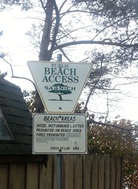 My mom was over to visit me about a week ago, and she gave me a book called Secret Beaches of Greater Victoria (by Theo Dombrowski), and I have decided to start exploring my way through the book. I live practically surrounded by water, so why not really get to know my area, know the beaches that are good for dogs, for BBQs, for frisbee, for beachcombing, etc.
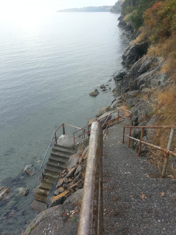
Stop number one was D'arcy Lane (Beach #46 of 92) which caught my attention with the headline "A huge flight of stairs down a cliff face to the quiet of Cordova Bay and its mixed shore of rock and sand." Sounded lovely.
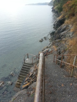 Well I was a little surprised by what I found. In fact, I had to laugh as my first attempt to seek out a secret beach led me to.... the water. At the end of this magnificent set of stairs, there was nothing but ocean. No beach to speak of. Perhaps the book should have mentioned how important tides were?
But the views were lovely - looking out at islands - D'arcy Island, the namesake of both the beach and lane being one of them. The coolest thing for me was this one small rock - the lone area on the horizon where the sun was shining - just covered in white birds. Probably sea gulls, but it was too far away to be certain.
Back at lane, there was a plot of undeveloped land - and I went to explore, hoping to find another set of stairs down to a perhaps existent beach. Instead, I found a blackberry bush - completely untouched. Some berries were so ripe and ready that they fell off at the touch. I wish I had brought a bucket with me, these berries were so delicious!! I ate to the point I thought I might make myself ill, and then tore myself away. What a treat!!
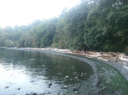 Disappointed by my lack of beach finding, on the drive home, I followed the signs to Arbutus Cove (which actually turned out to be beach #50 in the book). And this stop delivered! At the end of another set of long stairs through the woods, I was awarded with a lovely long pebbly beach - with excellent climbing rocks on one end. I would have loved to have spent more time here, climbing on the rocks and seeing how far I could walk the shoreline. It is an area I will be going back to.
Although the beach was lovely, my favorite thing about Arbutus Cove were the trees - and the namesake of the beach. The Arbutus trees are phenomenal!!! So huge and majestic... such a beautiful tree. :)
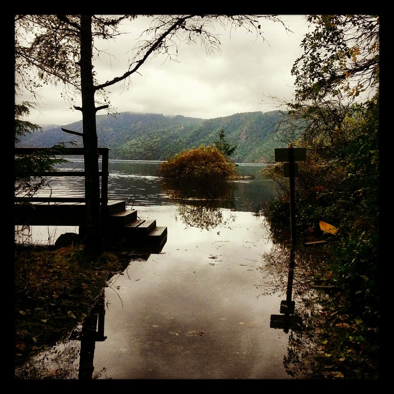
I have no idea what this is going to end up looking like as I am writing my first ever post on my IPad. I've been in Victoria for the last few days and have not had Internet access... We are now in Starbucks reconnecting to the online world.
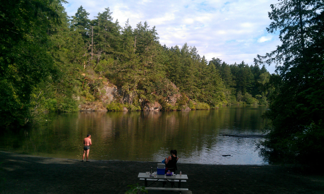
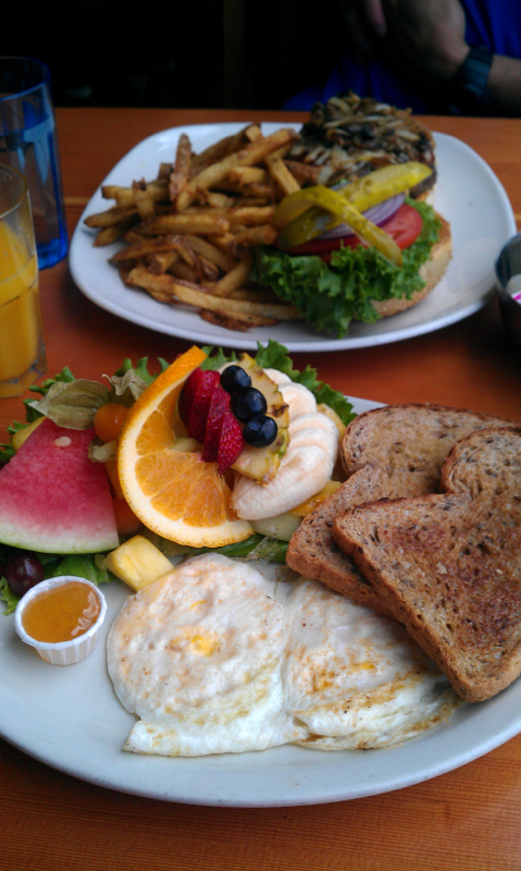
That picture floating around somewhere on this page is Thetis Lake... It's a beautiful place i cannot wait to explore more. There are two 3 km loops around two beautiful lakes with ideal trails for running.... Plus I think there are some trails that lead off up into the mountains that are calling to me. There is the best breakfast place I have ever been to (and I have been to a lot!) in Victoria... The Blue Fox. Even at 1pm on a weekday there is a 45 minute wait for a table. But it is totally worth it.
All righty, this IPad app is not the best... It has taken me about 20 min to type what I have written so far and the random addition of capitals and line breaks are frustrating me! Perhaps this is more a problem with my incredibly small hands and short fingers than the app itself...
|


 RSS Feed