I have been looking for a forever home for my blog these last few weeks and think I found it - JustAmbling.com - so please be aware all new posts will be appearing on that site. Thanks so much for reading :) D
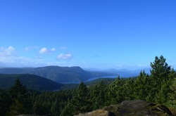 Mount Work - what a strange, not particularly enticing name. Who wants to hike a mountain when they are reminded it is work? Maybe Mt. Stroll in Woods would be a better name. But it should actually be called Mount Wark - as it was named after John Wark (the fur trader, not the soccer player). When Wark joined the Hudson's Bay Company in 1814 he Anglecized his name to Work... and there you go - the story behind the name Mt. Work. The main excitement of the day was the wind... and what a wind it was. Something maybe only Island people would understand, because I have never felt wind like this in Vancouver. The entire hike up I could hear the trees cracking and popping as the wind readjusted and tested them. Small branches breezed my my head. I came up with my plans for if a) a tree was going to fall on me - run like hell and b) a giant branch came sailing at me - jump, duck, run.... It was windy. I found it rather humurous that the beginning of the trail had a handful of signs pointing to the summit, but once I got up there... I had no idea, and still don't really KNOW, where the summit was. There was a flat expanse of rock with a beautiful view up Island that I will call the summit - unfortunately I did not take much time to enjoy the vista because the wind was particularly strong without the trees to break its full force. I had to brace myself, legs apart, knees bent, shoulder to the wind... just to keep standing. I squatted down (less surface area?) to take a picture, and was blown over. So needless to say, I did not stop to enjoy my snack. The trail carried on past the summit and down the other side - I followed this part way, still in search of the perhaps official Summit, but turned back after awhile - the trail was becoming slightly hard to follow and my ears were particularly icy.
If you are thinking about hiking Mount Work - check out this project I am working on for some more details.
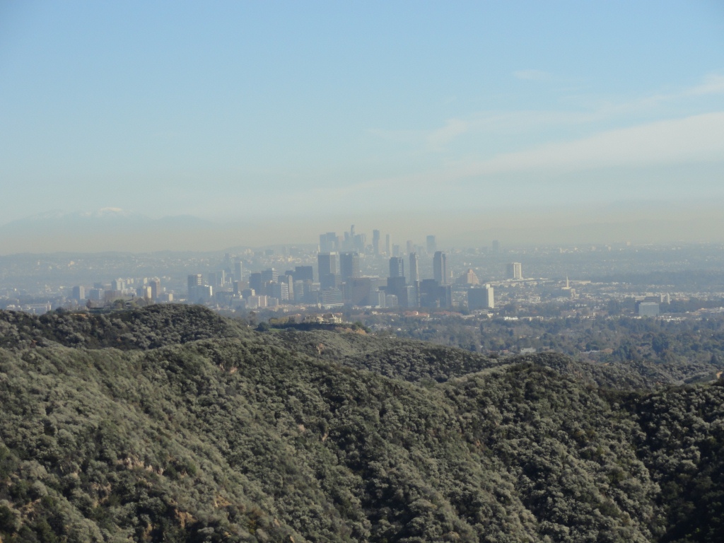
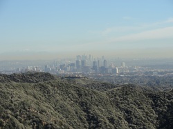 Have you ever played video games and realized that you haven't blinked for the last 10 minutes? Or breathed for that matter. That is what driving through LA is like. There is so much traffic and so many idiots trying to zip through cars standing still, you are just hoping and praying you aren't hit. Seriously I was. After noticing about 5 pairs of cars in various states of disrepair pulled over on the curb with the drivers out and yelling, I started to worry I might be next. I couldn't get to Santa Monica fast enough. You see just north of Santa Monica - the pier, the promenade, the beach - are the Santa Monica Mountains.
The trail I chose was called Temescal Canyon and yelp users had given it an almost perfect 5. It was a pretty steep ascent with spectacular views in every direction. If you looked North, you could see the mansions of Malibu with their Olympic sized swimming pools and manicured palm trees. If you looked West, you could see Santa Monica Pier as well as every other beaches' pier dotting the coast. And if you looked South, you saw the highrises that marked the madness of LA. And if you looked East - well you saw the trail sneaking up through the woods, a little piece of wilderness, an oasis, within this urban sprawl.
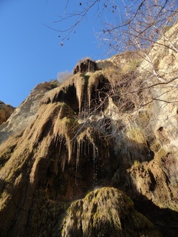 Although the Santa Monica Mountains offered enough hikes to keep me blissfully entertained for weeks, I only did one more trail - Escondido Falls.
I had read reviews saying these falls were more like a trickle, so I lowered my expectations and was pleasantly surprised. Although the amount of water was slight, the height it fell from made it spectacular. For the first mile or so, the "trail" was meerly a dirt path along the streets of residential Malibu - this was a bit of sightseeing in itself - looking at people's private tennis courts and riding stables. There were signs everywhere telling hikers not to stray from their path - it felt a little bit like we were not wanted here, but they would put up with us....
When the trail finally entered the woods, it snaked back and forth over a small creek - and eventually to the falls. Well... or it should have, but I took a wrong turn and first climbed (a bit precariously) to the top of the falls, and then came down and had a closer look. I noticed a hidden rope among the rocks that would have allowed people to climb up under the falls - but since I had all my stuff with me, and it would have got soaked (plus it looked rather slippery), I decided not to. Seriously one of the harden things to walk away from - it would have been so cool to go up under there!!! It was one of the first moments I really, really wished I had someone there with me. I had another moment of longing for a companion earlier this morning when I was reading about the abundance of ticks in this area (active October to March ... right now!) with a small percent carrying Lyme disease.... yikes.
Now to update you on my actual whereabouts - I am back home in Victoria. I spent the next day exploring Ventura Pier and cycling the coast a bit, then decided to drive home. I slept in my car for a few more nights heading back to Vancouver (I sleep so well in my car, its pretty astonishing) - got detained at the border as they asked me if I had installed any secret compartments in my car, went through my wallet and my phone... apparently my free spirit and wandering soul fits a certain profile....
Until next time ;)
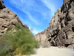 Palm Springs area - which is really a string of 6 or 7 or like 20 towns making up the Coachella - is a bit of a strange place. The majority of the population are snowbirds escaping the cold Northern Winters. I do not think I saw one person under 50, except the employees at Starbucks. That alone doesn't bother me... I was kind of hoping to make friends with an old grampa and play crib and drink tea (didn't happen). However I found the abundance of gated communities and golf-cart lanes rather disconcerting. I stayed however for the hiking.
I was told to do the Painted Canyon/Ladder Canyon Hike by a friend back home, so I had to check it out. And I am sure glad I did!!
What begins (see above) as a wide sandy path through the canyon turns sharply into a clausterphobics nightmare. The walls close in, sometimes to the point where you have to put one foot directly in front of the other and not beside, and you start to ascend a series of ladders up the steep canyon walls. It is magnificent!!
 The other thing I couldn't leave Palm Springs without (besides a picture of the massive Marilyn Monroe statue) was a ride on the world's largest rotating tram car up from desert to snow. The Palm Springs Aerial Tram was the dream-child of Francis F. Crocker who wanted to "go up there where it's nice and cool." So simple. But the problem was it was only 1935 and this seemed ludicrous. In 1961 construction began and some considered it the "8th wonder of the world." By 1963 the tramway was completed - Mt. San Jacinto, 10,834 ft, could be ascended in minutes. In 2000, the tram cars were modernized and this is when the enticing rotating cars were installed. This means that every single person in the car has two opportunities to look both at the amazing desert view below and the oh so different forest above. As we were riding it up, the recorded voice on the loudspeaker told us that this 11-minute journey was the equivalent of going from Mexico to Alaska as far as ecosystems are concerned. Once you get to the top, many people just go to the restaurant and the viewing deck - but there are also miles and miles of forest to be explored. I just did a 2 mile loop to take in the vista points - ie. take pictures. I controlled myself though - so not a million pics like j tree (as the cool people call it! lol). Links: Hike: http://www.hiking-in-ps.com/meccahills.phpAerial Tram: http://www.pstramway.com/
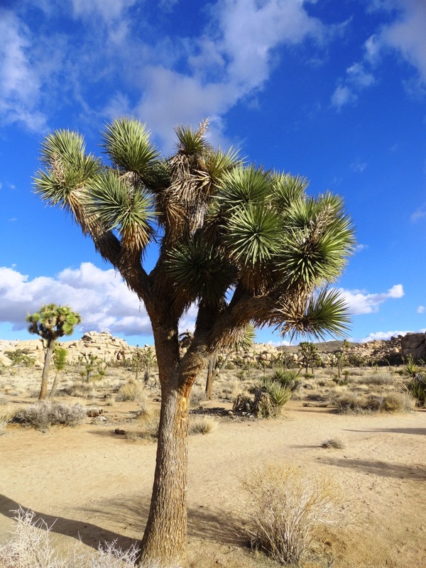
 This is a Joshua Tree. It is not actually a tree, but a yucca - and what's a yucca you say? Well I am not really sure what you could compare a yucca too... they have spiky leaves and spongy centers - not rings like a tree has. It took the name ``Joshua`` in the mid 19th century when Mormon immigrants saw the tree and its outstretched limbs appeared to reaching out to the sky in prayer... or something like that.
The trees have been used by people throughout time - Native Americans wove its tough leaves into baskets and sandals and ate both the seeds and flower buds. Homesteaders used them for fencing and corals and miners used them as fuel for the steam engines.
We also learnt in our geography class this year that birds use their sword-like leaves to impale their prey - lizards. Although I was really hoping to either see this in action, or see the aftermath, I saw neither.
I did however see an abundance of rabbits (I counted 8 one morning), two massive birds which I with no knowledge of the subject, classified as owls, as well as a coyote (prowling around the campground).
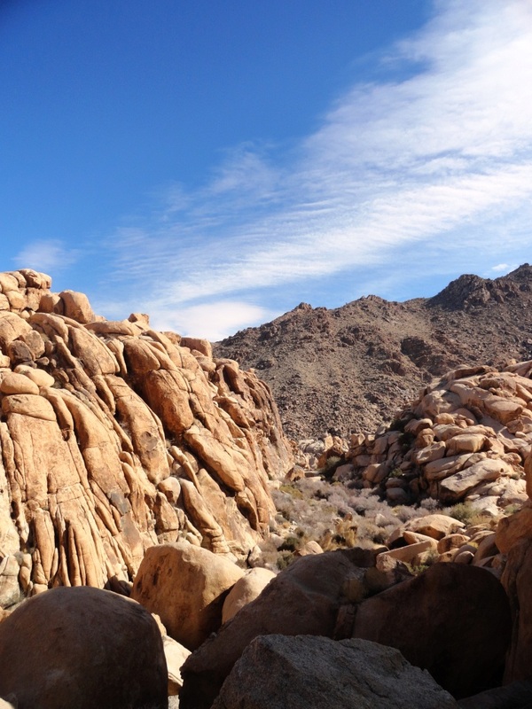
 My favorite place in Joshua Tree was the Wonderland of Rocks and more specifically hiking around Rattlesnake Canyon (yes there are rattlesnakes there, but not very active in winter). Anyway this place was amazing - I had heard it was one of the best hiking spots in the park - and I was happy to discover that this `hike` had no trails, no route, no destination. It was simply miles and miles of massive boulders to climb on! I had so much fun... and not even once (well for more than a microsecond) scared for my life. After my little incident in Death Valley, I was much, much more careful to make sure I could come down everything I went up.
I also loved the teddybear cholla (a type of cactus) garden. I loved it purely because it blew my expectations out of the water. I was expecting some little cacti you might miss if you didn`t look close enough, but in reality, I drove around a corner and boom - massive cuddly looking cacti everywhere! Unlike anything I have ever seen before. There were numerous warnings that although these things look approachable, you should not touch them in anyway because their thorns will find a way to burrow into your skin. Quite lovely.
I camped my second night in Hidden Valley, which was a beautiful yet very windy spot. The first site I chose was so windy that despite having put 3 large rocks in my tent, it started to blow away as I went back to the car. I had to sprint across the campground and grab it out of the air. Seriously. It was on a mission for freedom. I am sure I was quite the site for the guys hanging out in their truck right beside me.... I tried to look non-phased, like this happened to me all the time.
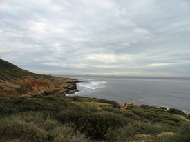 When Juan Rodriguez Cabrillo arrived in what is now San Diego Bay back in 1542 he called the place "A Very Good Enclosed Port." Glad that name didn't stick, what a mouthful that would be! His ship continued up the coast somewhere into Oregon but Cabrillo died along the way.... As the first European (Spanish) explorer to the coast of California he was a pretty big deal and the tip of Point Loma became the Cabrillo National Monument.
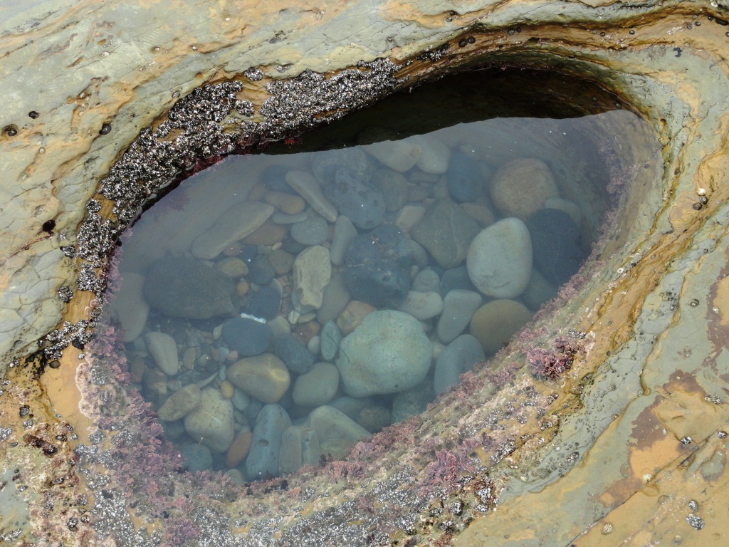
Unaware of the historical significance of the point, I was drawn by the promise of beautiful views of city and ocean, as well as the nearby tidal pools.
 Now I had read on Yelp that these Tidal pools had recieved a 4.5 out of 5 stars so I had pretty high expectations.... bright colors, sea stars, anemones maybe even some fish?? Hmmm no, not quite... more like different shades of gravel. But the holes were nicely eroded away. See this is the problem when you have expectations - it becomes so easy for things to fall short. Much better to have no expectations and always be pleasantly surprised.
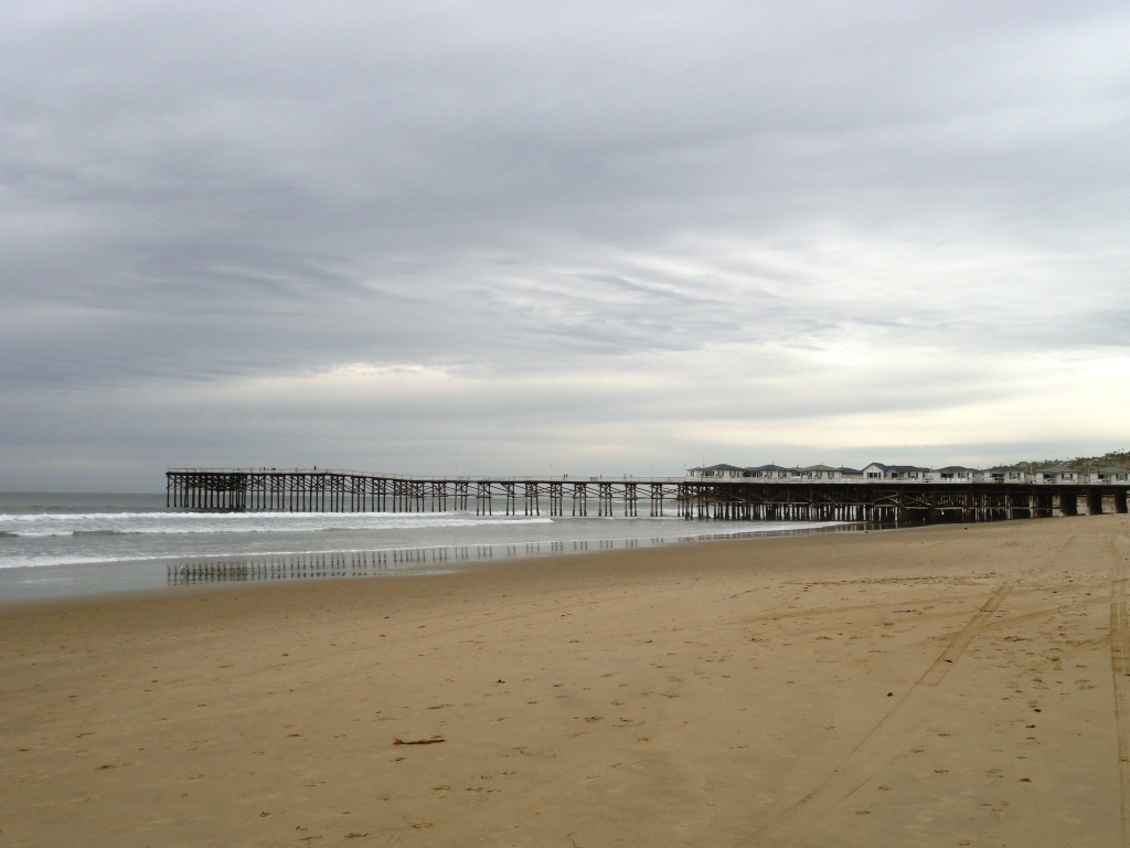
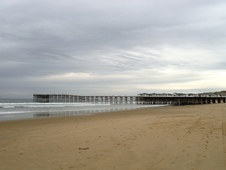 After spending a couple hours exploring the limestone cliffs and enjoying the views, I headed to Mission Beach. This is the type of beach I love - with sand stretching as far as you can see (or according to wikipedia - about 2 miles). And the nice type of sand - not the Vancouver kind that is really very small rocks waiting to lodge themselves into your sole.
A good spot to sit, create sand sculptures, listen to random people play the guitar and people watch - why are kids always digging holes? A couple of other highlights of the day... and by highlights, I mean food of course: - Delicious cappuccino and mocha chocolate muffin at Reds - Tried a California Burrito: french fries, steak and cheddar cheese, as well as a Carne Asada burrito: steak, guac and... salsa fresca - And was made yummy tacos for dinner by James at the hostel - great place to stay by the way: R K Hostel
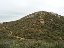 I consulted Yelp again to find a good hike to do in San Diego and it came up with Cowles Mountain. The highest peak in the city - which is only 1,593 ft (in comparison the Grouse Grind at 2,800 ft, it was a walk in the park). In fact I noticed several people running up and down it several times! The highest I noticed was 3 times... who knows how long he had been there doing this though.
It was similar to the Grouse Grind - the parking lot was packed and this was obviously the locals' outdoor alternative to the gym. From the top, you can go over to another peak, but whereas the main trail must see 100s of people a day - this one maybe saw one, and today it was me. Well sort of. I started seeing a lot of what looked to be cougar scat on the trail (who knows what it was), and as the brush was growing up around me, I decided to turn back.
The next day I went out to La Jolla and watched the seals... please forgive me for including so many pictures of seals, but they all have such friendly faces!!
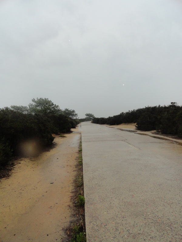
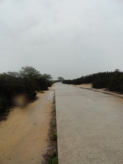 I also went out to Torrey Pines State Park. I had heard the hiking there was good, but when I got there - all the trails were closed due to the rain! So I just wandered along the paved road through the park thinking this kind of sucked.... but then! Two things happened. I stopped and read a sign which said this road was pretty important - it used to link San Diego to LA in the early 1900s. One particular hill (that I had just walked) was so steep that the early Model Ts (which used gravity to deliver gas to the engine) had to go up it in reverse!!! So I started walking backwards and pretended to drive.... sometimes I am sure people think I am crazy...
I also came across a golf course (through a chain link fence) and I think something pretty big was going on there by the large numbers of people out in the ran - so I watched for awhile.... and that night on TV I saw that Tiger Woods had been playing there! So lets just pretend I saw him!!
Just an update on me - I left San Diego yesterday - spent a lot of time watching Netflix and hiding out from the rain in some really sketchy motel in Hemet, and today I am off to Joshua Tree!
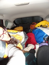 Apparently it is quite a well-known fact that most WalMarts do not mind if you park your car, camper, RV or Semi-truck in their lots and spend the night. Since hearing about it as a safer alternative to Rest Stops, I was hesitant yet curious to experience this for myself. The occasion came when I got to Sedona - all the hotels were at least $60, there were no hostels and camping was $18... which seemed a bit steep for camping - plus there would be no WiFi and if I wanted a fire, that's another $10. So I googled WalMarts in the area, and found a 24hr supercenter about 15 minutes away in the less touristy town of Cottonwood. I pulled in around 5pm - about the time I come in from the hills as the sun comes down, and was pleasantly suprised to find there was a McDonald's at this location! This is not exciting because of an addiction to McNuggets, but because they offer free WiFi. And as I was soon to find out, make an awesome cup of Orange Pekoe tea. Felt right at home! I settled in for the next 4 hours - sipping my tea, writing the blog, making faces at the laughing baby beside me, and trying to guess who else was doing as I was. There was one older man who looked a bit like a fisherman - you know like trench coat and hat, shoulder-length scruffy hair and more wrinkles than I have ever seen on one human face. And reminded me of the man in Home Alone who MacCauly Culkin is scared of at first... this man was like that... but when he noticed me making faces at the kid, he smiled at me with a twinkle in his eyes.... We saw each other again the next evening - it was kind of nice in a way to have someone to smile and twinkle eyes at. And sleeping in the car - lovely! I switched directions from my first time - so my feet could fit between the passenger & drivers seat in the front and perfect! Seriously having a great sleeping bag makes all the difference. Although I am staying at a hostel in San Diego (according to a no-park list, you cannot sleep at a WalMart in San Diego), I actually am looking forward to getting back into my car and my sleeping bag ;)
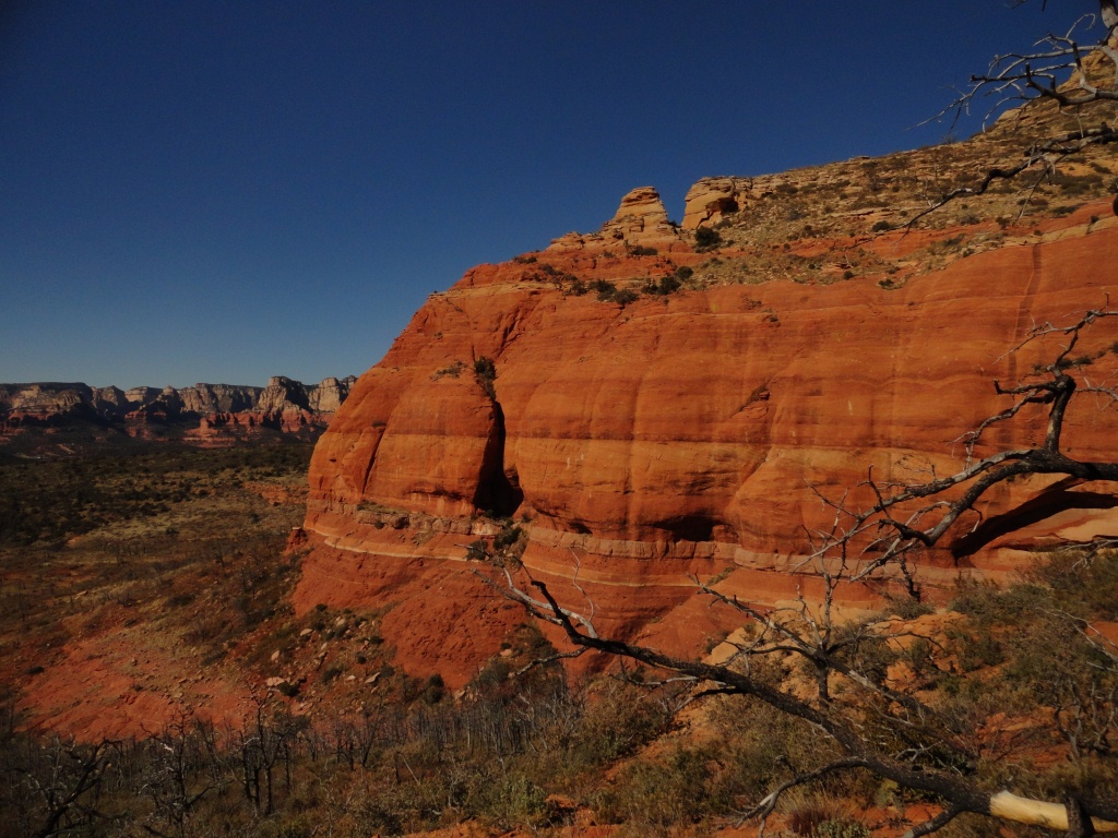
 Imagine clear blue skies with temperatures in the 20s and miles and miles of red rocks waiting to be hiked - if there is a heaven this is it!
On my first day I got really lucky and found an awesome trail system completely by accident - I was turning around on some backstreets and noticed a sign pointing to a trailhead. I was in a state of awe... I have never seen country like this before and it is so beautiful. The trail led up to Mesa Grande - a flat section with views of red rocks towering up from the ground.
From there I took a little detour off the main drag - and as luck would have it - ran into a group of javelina. These are wild boar and are quite harmless according to a man I met on the trail. They just can be a bit blind, so you do have to let them know you are there - apparently if they walk into you, their tusks can do some damage. I was especially lucky because there was a baby in there midst! And there is nothing I love more than baby animals!
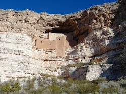 The next morning I headed out to the Montezuma Castle & Montezuma Well National Monuments. These are both sites that were once inhabited by cliff-dwelling tribes. The original name these people called themselves is unknown, but have since become known as the Sinagua ("without water"). It is thought that these people migrated into the valley by about 1125 and left mysteriously in the early 1400s.
The Montezuma Well is a limestone sink formed from a collapse of an underground limestone cavern. Along the edges of the sink the Sinagua had built homes in the caves. Unlike sinkholes I have visited in Mexico where swimming was a delight, there is no way I (or anyone probably) would swim in this one. The reason for this is that it is teeming with leeches! Ugh. There are two creatures in this world that creep me right out and I get a little concerned if they are near me and those are leeches and ticks. I just shivered writing that.
After getting my history fix, I headed back out into the outdoors and followed some more trails. The first trail was a miss as it mysteriously disappeared in a large boulder feild and even though I went everyway possible, I could not pick it up again. The second one was much better, but I was short on daylight hours. I wanted to reach the peak of Mt. Wilson, but only made it to the first summit - still wonderful views of the surrounding country and the town below.
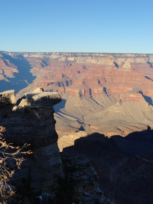
 Have you seen the movie Guilt Trip? There is a scene where they stop at the Grand Canyon, and they wonder how long they should look at it before it is ok to move on.... that is about how I felt. There were hiking trails along the rim, but I had hurt my knee yesterday in Vegas - so those were out of the question. Instead I stood at the viewpoint, took about a million pictures, and then drove on. The whole experience was a bit underwhelming. I had driven 5 hours to get here and spent all of maybe 15 enjoying the view (and it is a spectacular view, don't get me wrong). But how can you not go see the Grand Canyon when you are so close??? Some quick facts: the Grand Canyon is 446km long, up to 29km wide and 1.6km deep. Pretty impressive indeed. You can do a 34km hike to go from Rim to Rim (meaning you go down to the river and back up the other side... how do you cross the river I wonder, must be a bridge). I would have loved to have done this!!! Next time :) The Grand Canyon is considered one of the 7 Natural Wonders of the World. When I heard this I wondered what the others were - so if you are like me, here you go: - Great Barrier Reef
- Harbor of Rio de Janeiro
- Mount Everest
- Aurora Borealis (I can cross another off the list!)
- Paricutin volcano (in Mexico)
- Victoria Falls
There is also a list of the New 7 Wonders of Nature.. but these do not include the Grand Canyon, so moving right along. Apparently there is some great debate among geologists over how the Canyon was formed - seems right now they think the Colorado River established its course through the canyon 17 million years ago!
And to think, I only spent 15 minutes, if that, enjoying Mother Nature's handiwork.
|


 RSS Feed